
build interactive dashboards for Geospatial Analytics
ARLAS-Builder is a comprehensive studio environment that we specifically designed for the creation and customisation of interactive ARLAS dashboards. Here, users can set up the exploration, visualisation, and analytics of extensive volumes of geospatial data without requiring any coding expertise.
Through its intuitive, no-code interface, ARLAS-Builder lets you configure all essential elements of a dashboard, including the integration of diverse geographic layers, the arrangement of insightful widgets, and the overall aesthetic and functional characteristics that define the user experience.
BEFORE YOU START: INGEST YOUR DATA
Your journey with ARLAS starts with you choosing how you would like to deploy ARLAS, in steps meticulously outlined in the ARLAS quick start guide; you can deploy it on infrastructure of your choice or use ARLAS-Cloud, our ARLAS SaaS offer. Then, you can ingest your data, a process detailed comprehensively here. We recently simplified this process through the ARLAS Command Line Interface (ARLAS-CLI) as shown in this step-by-step guide is readily available here.
Once your data is successfully integrated into ARLAS, ARLAS-Builder provides an array of features that allow you to define precisely how users will interact with this information through the dashboards you create.
EASILY BUILD DASHBOARDS FOR DIVERSE USERS AND USAGES
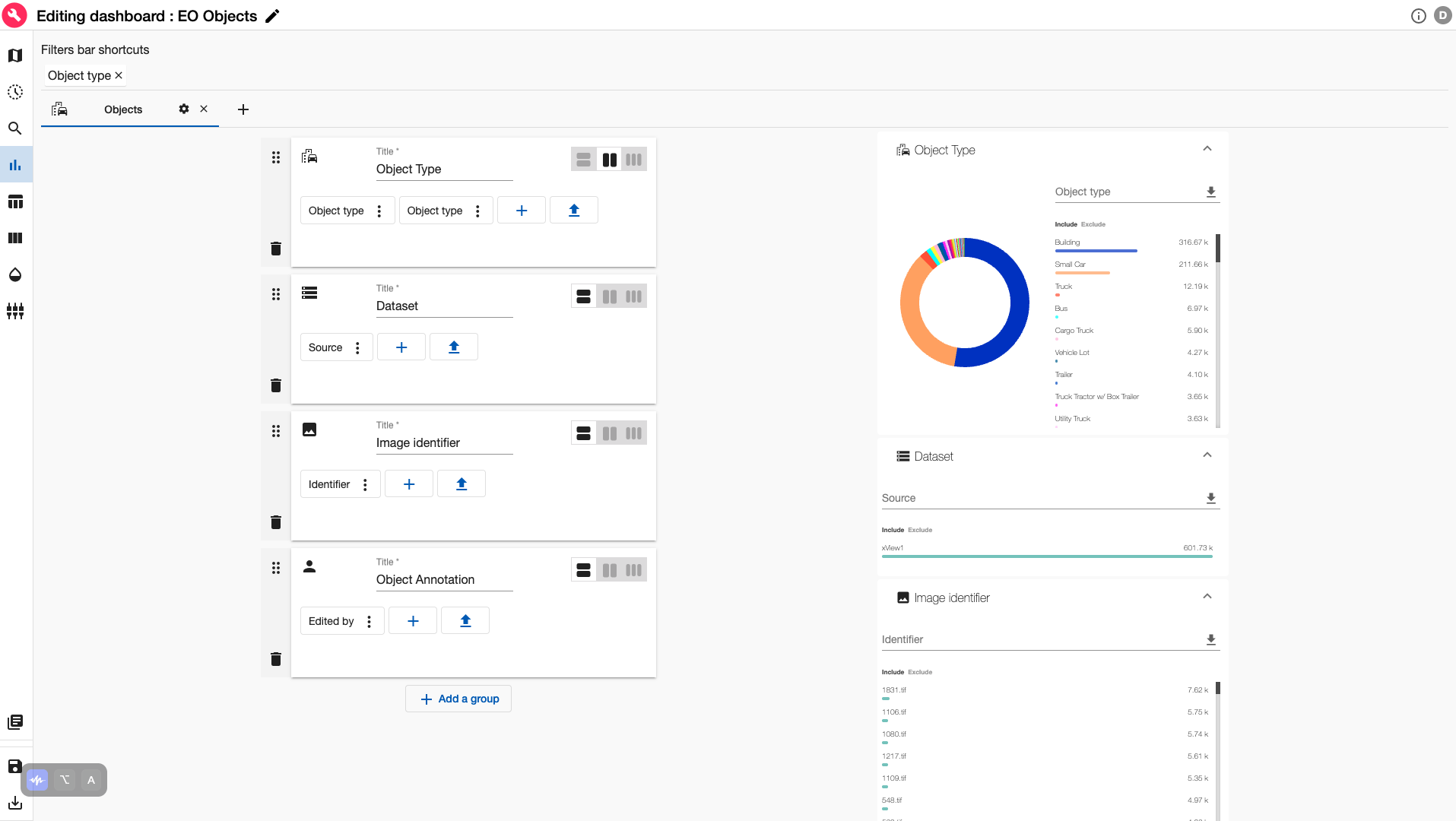
ARLAS-Builder offers users a rapid and straightforward method for customising the various parameters, visual appearance, and interactive behaviors associated with your geospatial data. Within this studio, you have complete control over defining how you, your collaborative team, and other designated users will engage with the information. This flexibility allows for the creation of sophisticated dashboards for users with advanced technical proficiencies, as well as simplified interfaces designed for end-users with varying levels of technical competence who primarily require easily digestible information. A series of analytics widgets like metrics of data, donuts and powerbars are also proposed for configuration in the ARLAS-Builder
It only takes a couple of minutes to configure these diverse user experiences and for different geo data types from multiple sources.
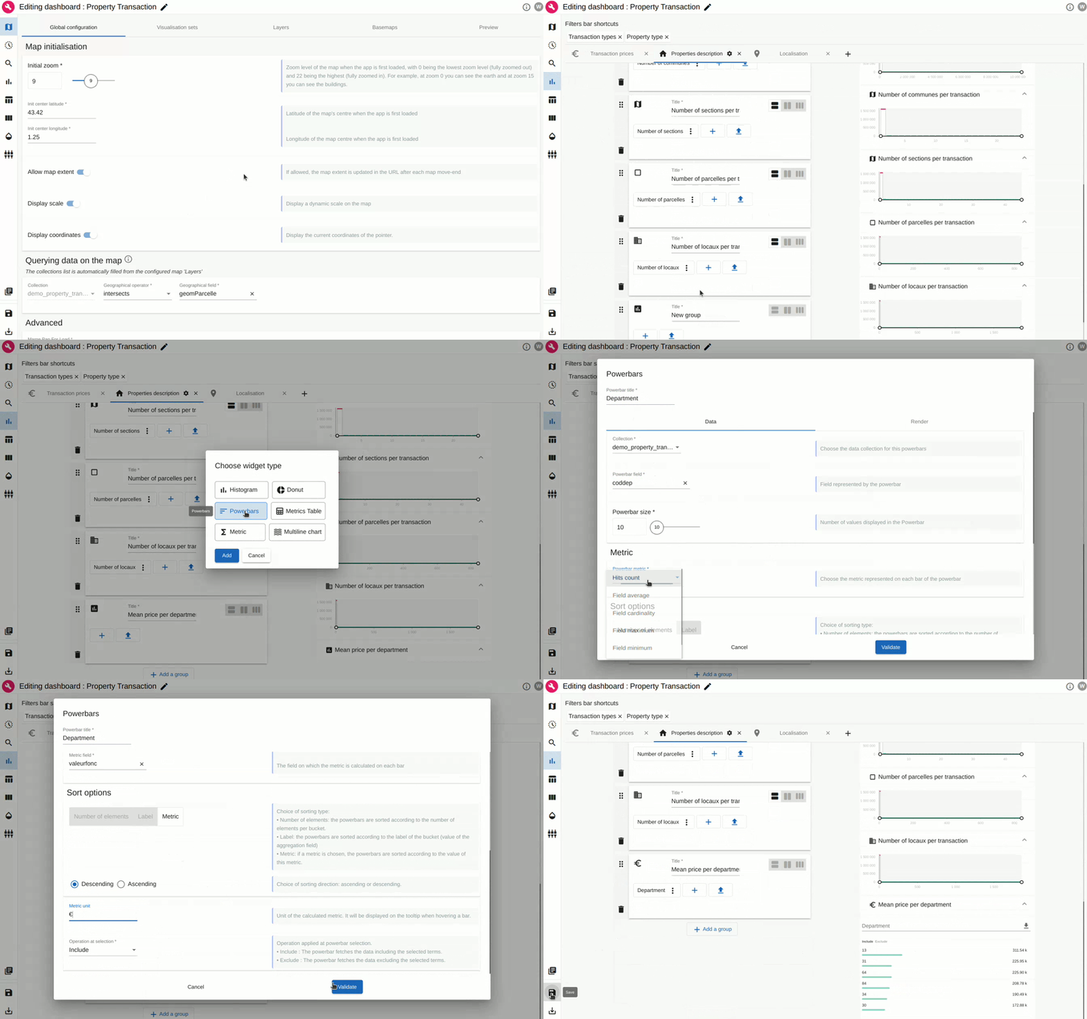
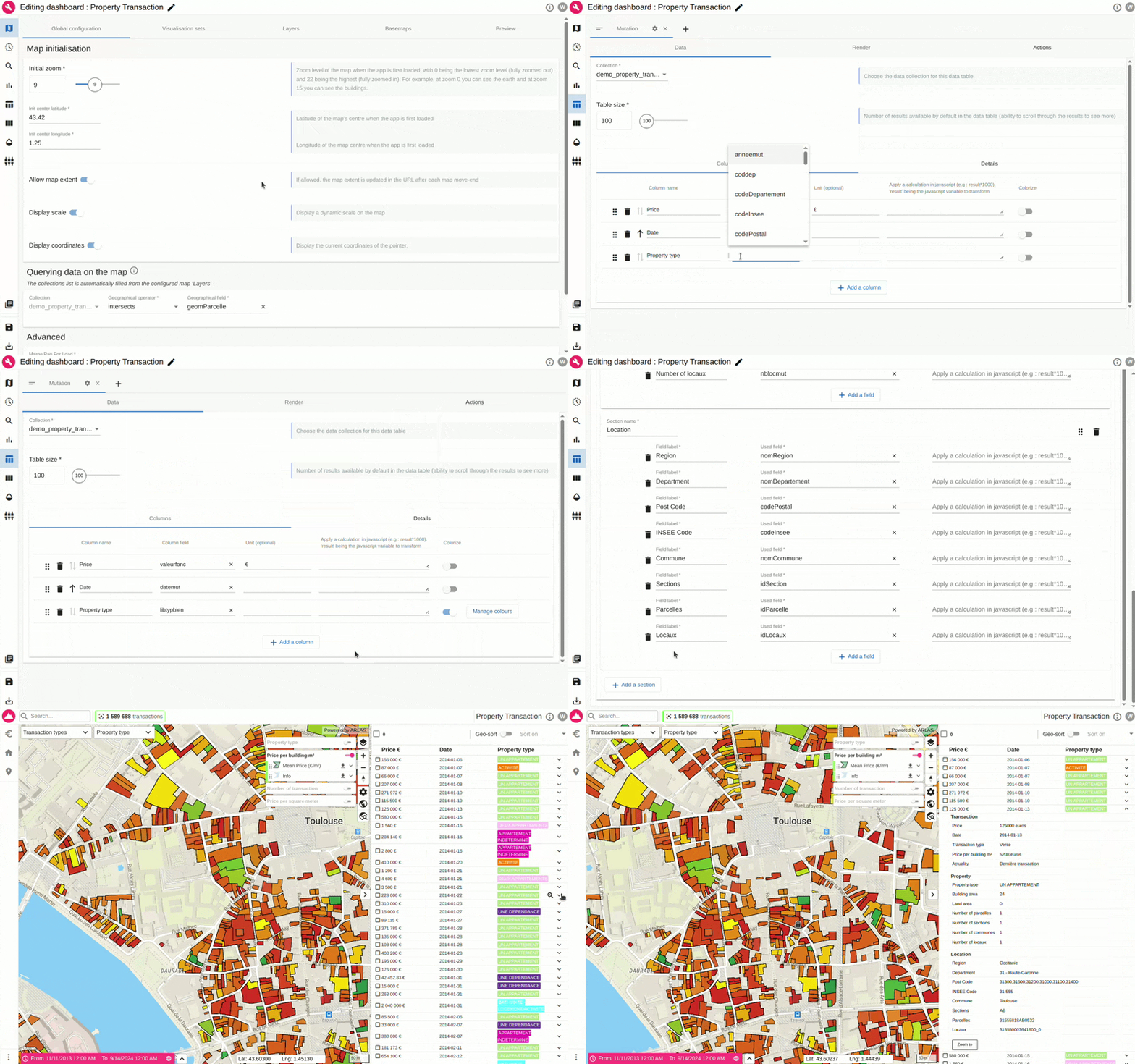
Below, we dive into ways in which you can configure some of the widgets on ARLAS-Builder. Widgets like the map layers that determine users’ understanding of the geographical information or the data table which helps display tabular data, or even the display of images like Earth observation objects.
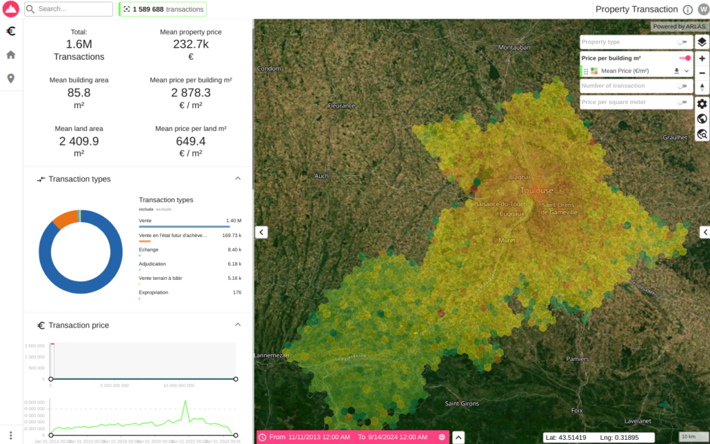
Example of aggregated price map layer and analytic widgets
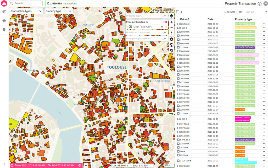
Example of property borders map layer and a data table
CREATING MAP LAYERS WITH ARLAS-BUILDER
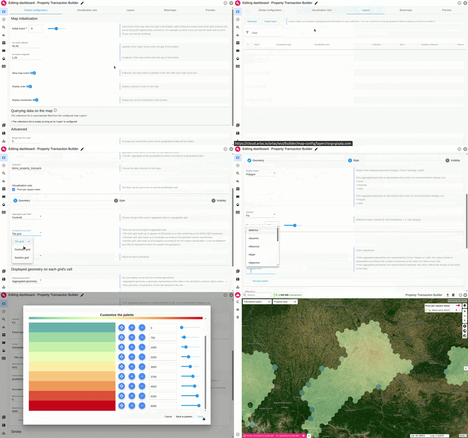
CREATING WIDGETS WITH ARLAS-BUILDER
CREATING A DATA TABLE WITH ARLAS-BUILDER
GET PRACTICE WITH ARLAS-BUILDER
To gain practical experience and a deeper understanding of how to initiate projects with ARLAS-Builder, you can follow the detailed guide provided in one of our comprehensive tutorials available here. These tutorials offer hands-on exercises and real-world examples to accelerate your proficiency with the platform.
Claim A Free ARLAS-Cloud Access
We recently opened up free access to ARLAS-Cloud.
This is a unique opportunity for you to establish your own ARLAS-Cloud account and fully explore the extensive capabilities of the ARLAS suite. We encourage you to take advantage of this offer to test ARLAS’ analytical power with your own datasets and discover its potential for your geospatial data projects.
Our commitment to providing a seamless user experience is reflected in our continuous efforts to introduce new and enhanced features to ARLAS. To stay informed about the latest developments, feature additions, and improvements, we invite you to follow our blog for regular updates. This is your direct channel to stay abreast of the evolving capabilities of the ARLAS stack.
Whether you have inquiries regarding our various demos, require clarification on specific functionalities, or are seeking expert support for your geospatial big data projects, please do not hesitate to reach out. We are here to assist you in maximizing the value you derive from ARLAS and to ensure the success of your geospatial initiatives.
GET IN TOUCH
Share the Post:
LinkedIn